Woke a couple hours before sunrise this morning. The sun is setting sooner and rising later, and who can sleep all those hours in between? I can’t. Besides, I wanted to get a very early start on the river today. If I’m going to meet my pickup in Morgan City this Saturday, I need to do 25 miles a day. Which is just below my daily average.
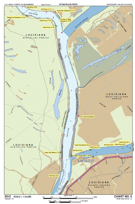
Paddled the remaining two miles down the Lower Old River to Three River Junction – the point where the Lower Old River, the Red River, and the Atchafalaya River meet.Turn right and you’r paddling up the Red River and on your way to New Mexico. Turn left and your on the Atchafalaya headed towards the Gulf. I turned left.
For everything I expected the Achafalaya to be, the first 25 miles were not it. I expected a somewhat smaller, more intimate river than the Mississippi. Which it sort of is … and isn’t. What it is is a broad river, not as wide as the Mississippi, but wide enough. It’s about a half mile wide and, like the Mississippi, when your in the fast water near the middle of the river, the banks are far enough away that you still see binoculars to see things with detail.
The water in the river is moving at a pretty good clip, though. I was worried it wouldn’t be. It’s fast enough that 25 miles a day should be very doable. And there are far fewer, and a lot smaller, barges than on the big river. I only saw two barges all day. Which was very nice.
Unlike the Miss, the levees are built right along the Atchafalaya and not set back miles away. So, the few towns I’ll be paddling through are accessible. However, those towns are very small and have little in the way of services I need, so I’ll just be paddling through on my way south.
In short, for my family and friends in Illinois, when you think the Atchafalaya (or at least the first 25 miles of it), think of the Illinois River down near Starved Rock, but with levees. It reminds me a lot of that.
So what’s so special about the Atchafalaya anyway?
Well, first, for a paddler doing the Mississippi, it’s the best way to the Gulf and avoid Baton Rouge. Baton Rouge is a deep seaport with lot’s of ocean freighters. It’s very busy, very big, and no place for an old man in a canoe.
And second, it’s the way the Mississippi River would be flowing if the Corps of Engineers had not built in 1963 the Old River Control Structure and it’s three inflow channels (you may have noticed them on yesterday’s charts.) The Old River Control Structure prevents the Mississippi from diverting into the Atchafalaya and, in so doing, saving the ports of Baton Rouge and New Orleans from obsolescence.
In taking the Atchafalaya to the Gulf, I’m not only taking the fastest, shortest route, but I’m also taking the way the Mississippi River would chose to take if human beings let her. So, in a way, I’m striking a small, but futile, blow for mother nature. Go, mother nature!
N.B. One other good investment made for this trip – my $7 mosquito head net. It works great!


Leave a comment